All Hikes
Click here for our interactive Hike Locations Map.
Abbott Marshlands: John A. Roebling Memorial Park
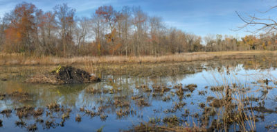
If you’ve ever driven south of Trenton on Rte. 29, you’ve probably noticed that the interchange with Interstates 295 and 195 is built in the midst of a major wetlands. The area, known alternately as the Abbott Marshlands, or on …
Baldpate Mtn: Eastern Trails
Lovely trail section of the Baldpate trail system, recently re-blazed with drainage improvements. Less steep than Summit or Switchback trails, but lovely in its own right. We suggest loop hike: Kusar Mountain to Copper Hill (either branch, western
Baldpate Mtn: Overview and Summit Trail
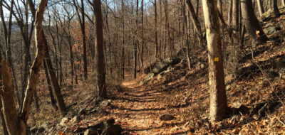
Utterly beautiful. 12 miles of hiking trails with up to a 400 foot elevation gain. 20 minutes from downtown Trenton. Need I say more? This is the jewel of the Mercer County Park system, and one of the nicest small parks in all of NJ. (Driving time is
Baldpate Mtn: Pine Grove Hike
Suitable for hiking or biking (see Biking Notes): This has been one of our favorite walks on Baldpate for years, but we've never written about it in part because a critical segment was missing from the County's map. This hike takes you through one of the
Baldpate Mtn: Switchback Trail
The Switchback Trail delivers 425 vertical feet by itself, and you can achieve a cumulative elevation gain of nearly 1,000 vertical feet (well, OK, 950) by combining it with other trails. Rated Experienced for elevation gain)
Berry Picking in Local Parks
Every July, usually a week or two after the 4th of July, the wineberries (wild raspberries) start to ripen in open shade along the slopes of local mountains more than 300 feet or so above sea level. I'm not necessarily suggesting you need to go for a big
Bowmans Hill Tower Hike
Bowman's Hill climbs a bit over 300 vertical feet from River Road, with an average gradient of over 25%. That's pretty darn steep, and it's one of only a handful of spots within half an hour of downtown Trenton where you can gain so much elevation. Most
Bowmans Hill Wildflower Preserve
Bowman's Hill has changed my life. Truly. If you read these pages at all regularly, you know I am an avid outdoorsman and hiker. But until I spent a couple of hours getting a guided tour of the Preserve in mid-April, I'd never focused on wildflowers.
Carson Road Woods
Carson Road Woods is a superb, 183 acre swathe of preserved farmland midway between Princeton and Trenton. The preserve is a mix of woodlands and open fields, with mowed walk-ways along the margins. In a few places, trails are cut through woodlands,
Clayton Park
Part of the Monmouth County Park System, Clayton Park is an easy 25-minute shot from Trenton (off I-195 Exit 11). It's absolutely lovely, featuring 8 miles of trails through a mixed habitat of mature hardwood forest, wetlands, and fields. The topography
Curlis Lake Woods
The Curlis Lake Woods Trails loop through mature beech, maple, and oak trees and traverse a half-mile of undeveloped lake-shore. The trail system consists of a backbone trail used by horseback riders, cyclists, and walkers that alternates between open
Cushetunk Mountain Preserve
Cushetunk offers two different hiking options. If you park at Old Mountain Road in Lebanon, it's an intense 2.4 mile loop hike that includes a fairly strenuous scramble along a 0.9 mile ridgeline and an elevation gain of about 450 feet. If you park on
Drexel Woods
Drexel Woods is a flat hike in a tiny preserve that barely contains a mile of trails. It’s one we would normally consider of interest only to locals. What provides broader significance is the 2/10 mile section bordering the Shabakunk. … Read
Dry Run Creek / Rockhopper Trails
Just north of Mercer-Hunterdon County line is the Dry Run Creek trailhead, 20 minutes or so north of downtown Trenton by car. Maintained by the D&R Greenway Land Trust, it's a delightful, 1.2 mile trail that descends into Dry Run Creek* and then climbs
Fiddlers Creek Preserve
Fiddler's Creek Preserve is a 120 acre parcel directly south of the Baldpate Preserve, on the opposite side of Fiddler's Creek Road. It provides two miles of Beginner to Intermediate trails, none with more than 80 feet of vertical elevation change,
Goat Hill Preserve: Back Trails
Goat Hill Park was acquired in 2009 by the State of NJ, and is managed as a satellite park of Washington Crossing. The current park is mostly flat, but delivers 5 spectacular viewpoints, all of which are now accessible on blazed trails.
Goat Hill Preserve: Family Hike
Goat Hill towers 400 feet above the Delaware River, and provides spectacular views of New Hope, Lambertville, and Bucks/Hunterdon counties. Local legend has it that Washington visited the site before he crossed the Delaware. Kids will love the views and
Greenway Meadows / Stony Brook Trail
It took me 22 minutes to drive to the trailhead parking lot from Trenton. Once on the trail, you'll find yourself in a wild, tranquil world where everything seems to be right. No small feat. The path tracks Stony Brook along its flood plain. This
Griggstown Native Grassland Preserve
For years I’ve heard about the Griggstown Native Grasslands Preserve but was never motivated to visit. Frankly, “Grassland Preserve” may be accurate, but it’s terrible branding for a woodland hiker who loves slopes and finds most
Hacklebarney State Park
For beginning to intermediate hikers, Hacklebarney gives you a taste of what wilderness hiking is all about. The Park is truly beautiful, with trails that overlook tiny, pristine brooks that still support wild native trout (the brook trout), and descend
Hamilton Veterans Park
This is a town park that offers everything you’d expect, plus a surprisingly pleasant, if slightly surrealistic, woods-walking experience. We’re evaluating this as a woods-hike, and as such it’s OK, but there are much better places to
Hartshorne Woods Park
Hartshorne Woods is a magical place for walking or mountain biking (or fishing or birding), located on the highest coastal escarpment on the Atlantic seaboard south of Maine. A little over an hour from Trenton, east of Red Bank, and opposite Sandy Hook,
Haycock Mountain
Haycock Mountain is an entertaining, short hike (only about 0.75 mile from the trailhead to summit). You gain 460 vertical feet in this distance, which puts the average gradient about 12%, though the hike gets a fair bit steeper as you approach the
Herrontown Woods, All Saints & Autumn Hill
Writing this review was a struggle because the whole of these three preserves is less than the sum of its parts… Herrontown Woods sits in the center, and is charming. The trail system is well marked, and while there are … Read More
Institute Lands & Princeton Battlefield
The Institute Lands are a uniquely Princeton institution. Where else, in less than a square mile, can you walk in context of TWO seminal aspects of human history?
Institute Lands: The Battle Walk
To stay true to the Army’s line of march, we strongly suggest that you start this walk at the D&R canal parking area in the far SW corner of the map. Downloading the GeoPDF map and installing it on your … Read More
Jacobs Creek Trail
The Jacob's Creek Trail provides a little over a mile of paths along this famous creek, a charming, short reminder of a wilder time. The southern end of this walk is particularly lovely, because it passes through farm land not yet subdivided into
Laurie Chauncey Trail
The Laurie Chauncey Trail ("LCT") is a gorgeous, 2 mile loop around the fringes of the ETS Campus. It stands next to the Ettl Farm Trail ("EFT"), a second loop, which adds some scenic variations and another mile or so of hiking. Both trails track
Milford Bluffs: Thomas F. Breden Preserve
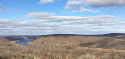
The Breden Preserve, 264 acres on Milford Bluffs, plus 30 acres preserved by the Nature Conservancy, provides a charming, and fairly easy walk to fabulous views of the river. (Driving time is 31-60 min, Rated Intermediate for elevation gain and because
Morisville Levee Walk
This is the only urban walk on this website, and it's really quite beautiful It's about 2.7 miles, and for most of it you can look out on the Delaware River. You will cross two bridges, and check out some of the best sights Trenton has to offer, including
Mount Rose Ridge
On its own, this is a charming, fairly steep little climb of about 120′ vertical elevation up and over the southernmost ridge in the Sourlands. It is the northernmost section of the Watershed Preserve’s main trail, but except for the …
Mt. Rose Preserve
Mt. Rose Preserve provides nothing less than a pleasant, 2 mile walk in the woods, but not much more (excepting a pleasant, much shorter walk in a meadow). The preserve’s trail “system” is simplicity itself. It supports two hiking
Mt. Tammany / Water Gap
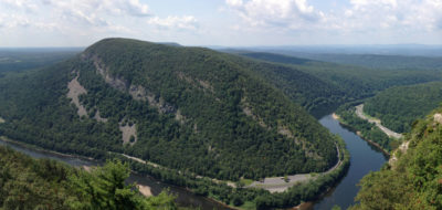
The Water Gap is one of the geologic wonders of the area, and the Mt. Tammany hike takes you to an awesome, panoramic view of it. Rising more than 1,000 vertical feet from the trailhead, it's a steep and challenging hike.
Musconetcong Gorge Preserve
The preserve is great fun, with a fantastic loop hike at its core, which you can extend in various ways. There's about 600 feet of cumulative elevation gain: some of the climbs are quite steep. There are also a couple of stream crossings. Usually you
NJ Brigade Trail at Jockey Hollow
Much less well known than Valley Forge, Jockey Hollow was where Washington's army spent the winter of 1777, following its victories in Trenton and Princeton. There's a beautiful, Intermediate hike through some of the National Park that preserves the area,
Omick Woods at Rocktown Preserve
Omick Woods, which opened in 2014, is yet another lovely, small hiking preserve created by recent, private preservation activity, in this case by D&R Greenway Land Trust. One of D&R’s crack trail construction crews laid out a perfect hiking
No post found
Load More


