Goat Hill Preserve: Back Trails
Open year round, dawn to dusk
(609) 737-0609 Website Google Maps Trail Map GeoPDF Buried Treasure
Gravitas: ![]() Challenge:
Challenge: ![]() Proximity:
Proximity: ![]()
Buried Treasure and Sights Unseen
Note: this review describes the back trails of Goat Hill Preserve, which offers a mix of blazed and unmarked trails. If you stick to the blazed trails we’ve rated it Intermediate. The unmarked trails in the south of the preserve can be tricky to follow and are recommended only for the experienced. Family Hiking opportunities on Goat Hill are described here.
Goat Hill Park was acquired in 2009 by the State of NJ, and is managed as a satellite park of Washington Crossing. It is potentially one of the most spectacular hiking destinations in central NJ: Imagine a steep, 400 vertical foot climb from Rt. 29 through the old quarry site! It could be the Breakneck Ridge, a wonderful hike in the Hudson Highlands, for Central NJ with the added allure of real of buried treasure, as reported in 1896 (see NY Times article). Was it all found?
Alas, Goat Hill isn’t quite that good (though it could be), as the Washington Crossing folks aren’t as ambitious for this site as we’d like. That said, the preserve in much better shape for hiking than when I first visited it in 2010. At that time there were no marked trails at all other than the “Overlook Trail”.
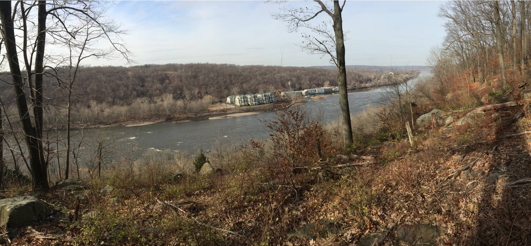
The current park is mostly flat, but delivers 5 spectacular viewpoints, all of which are now accessible on blazed trails. Most visitors to the park walk up the Overlook Trail (really an unpaved road) and see “Goat Hill Overlook” and what is variously called “Dining Rock” or “Washington’s Rock”.

Also, despite being the top of a mountain, significant parts of the park are wetlands (white areas with brown dots on the map), and can get very wet and muddy at certain times of the year. The Goat Hill trail in particular runs through wetlands, and can get quite soggy during the spring and after rains.
It you want to see all of the viewpoints, the easiest way is by following the Quarry Trail from Dining Rock. It’s clearly marked and has pretty good footing. It misses most of the wetlands, and is generally pretty dry. You can return via the Goat Hill Trail, but it’s not all that interesting and is often wet.
The two “unmarked” trails shown on the map provide some interesting variations, but follow them with caution. These paths generally are pretty easy to follow IF you know how — but even experienced hikers who are used only to well blazed trails may find them difficult to follow at times.
I would suggest following them only if you have one of our GeoPDF maps running on your phone (with plenty of battery). Recently I followed them both. The eastern trail actually is marked with discrete white paint blazes close to the ground. Any time I wasn’t sure where to go next I looked for a paint mark and generally found it.
The southern “unmarked” path is actually quite interesting with some of the steepest sections of any trail in the park. However, it’s not marked any way I could see, and I actually lost the trail at one point (the GPS track has an error of 50 feet, and the plot probably an equal error, so you can’t rely on it for every decision). To recover the path, I set marker on the trail a few hundred yards up from where I wanted, and used the Avenza app’s “navigate to” feature to get bearings. This worked OK, except I ran into a well defined “unmarked trail” that’s not on any map, and confused it for the orange dotted trail I was seeking. It took me in the wrong direction, which soon became apparent on my phone’s plot. So I doubled back and this mystery trail intersected with the mapped “unmarked” trail pretty quickly.
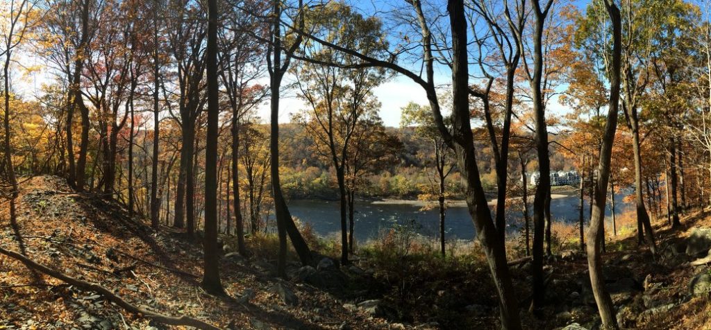
When’s the best time to visit? That depends on whether you just want to just see the viewpoints, or are looking to explore other sections of the park. If you go when the leaves are down, the Quarry Trail will provide virtually uninterrupted partial views of the river, which is quite entertaining. The blazes will make following the trails easy, but you’ll want to be particiularly vigilant about tick protection as fallen leaves are perfect tick habitat.
If you’re looking to explore the more mysterious parts of the park, probably September through late October would be the peak months, before leaves have dropped. The unmarked trails will normally be about as dry as they get, and won’t be obscured by fallen leaves.
Admin
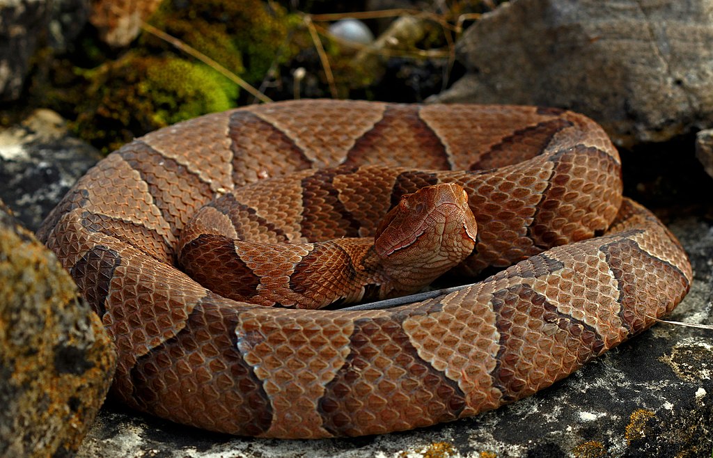
I just heard a report that a copperhead snake was spotted on Goat Hill in the past year. Frankly, in 30 years of frequent hiking I’ve never seen one. Copperheads are not aggressive, but will bite if they feel threatened (e.g. if you step on one). It wouldn’t change my opinion about hiking here, but you should make your own judgement. Image from Wikipedia under a creative commons license.