

Cushetunk Mountain Preserve
Ridge Trail Closed Jan 1 to Aug 1
(908) 782-1158 Website Google Maps Trail Map GeoPDF
Gravitas: ![]() Challenge:
Challenge: ![]() Proximity:
Proximity: ![]()
Cushy It's Not
There aren’t many places in central NJ where you can climb 400+ vertical feet. The closest is Baldpate Mountain, which is only 20 minutes away, but if you walk a lot, you get tired of hiking the same one or two trails. For experienced hikers only, Cushetunk offers an interesting scramble along a ridge with beautiful views (when the leaves are down) and a chance to see raptors. It isn’t super close (around an hour by car), but most of the other options are about the same distance away (e.g. Musconectcong Gorge), or even further.
Cushetunk offers two different hiking options. If you park at Old Mountain Road in Lebanon, it’s an intense 2.4 mile loop hike that includes a fairly strenuous scramble along a 0.9 mile ridge-line and an elevation gain of about 450 feet. If you park on Mountain Rd, in Whitehouse Station, you add a 2.5 mile long access trail that climbs 350 feet, drops 200, and then rises 150 before connecting you to the loop hike accessible from Old Mountain Road. Walk in and out of Mountain Road, and do the entire ridge loop, and you’re looking at a hike that’s about 7.5 miles and 1,100 cumulative vertical feet.
I’ve only walked the shorter loop and enjoyed it a lot. Most of the hike is fairly easy walking assuming you’re fit enough to handle the overall elevation gain. However, the ridge trail is not for the faint of heart, or inexperienced hikers. When I did the walk, the ridge trail was quite overgrown, and where it wasn’t overgrown, it scrambles up and down over a series of bouldery false summits. It forces you to move slowly, and it’s much more tiring than you’d expect for such a relatively short distance. Trail markers are also indifferently maintained, so you need to be confident in your ability to follow a trail without the reassurance of frequent blazes.
This issue with the overgrown ridge is more or less inherent in the way the preserve is managed. The ridge is home to nesting bald eagles, closing down the ridge trail between January 1 and August 1. That means it’s essentially unused during the prime growing season, giving vegetation plenty of time to grow in without hikers thinning it out through use.
When I visited in late September, I didn’t see any Eagles from the ridge trail, but I did see some raptors gliding on thermals just off the ridge, at nearly my eye level. Birders may want to bring binoculars.
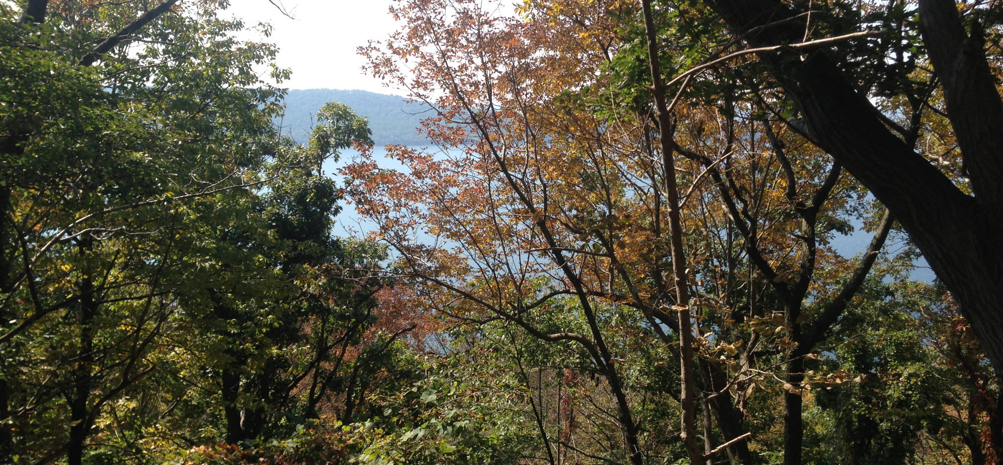
My suggestion would be to hike the trail after the leaves are down, basically November or December. The first frost should cut down some of the brush; more importantly, when the leaves are down you’ll be in partial views of the reservoir to the south and the Raritan Valley to the north much of the way. When the leaves are up, the views are intermittent, to be charitable. If it’s been cold, you’ll need to worry about ice. Note that this exposed ridge will average several degrees lower than most of central NJ, so start to worry whenever Princeton/Trenton temps start hitting the mid-30s.
I would strongly urge you to wear long pants when you walk this, even in Summer. The brush included lots of brambles, and a fairly healthy population of poison ivy and sumac.