

Musconetcong Gorge Preserve
Open daily, dawn to dusk
(908) 782-1158 Google Maps Trail Map GeoPDF
Gravitas: ![]() Challenge:
Challenge: ![]() Proximity:
Proximity: ![]()
Variety is...
Musconetcong Gorge Preserve is one of my favorite hikes in the state. Yes, it’s about an hour away. But it’s one of the most beautiful, and least stressful, drives you can do in this state: up the Delaware Valley along Rt. 29 past Frenchtown. Add a meal in Lambertville, Stockton, or Frenchtown, and you’ve got a fabulous half-day excursion.
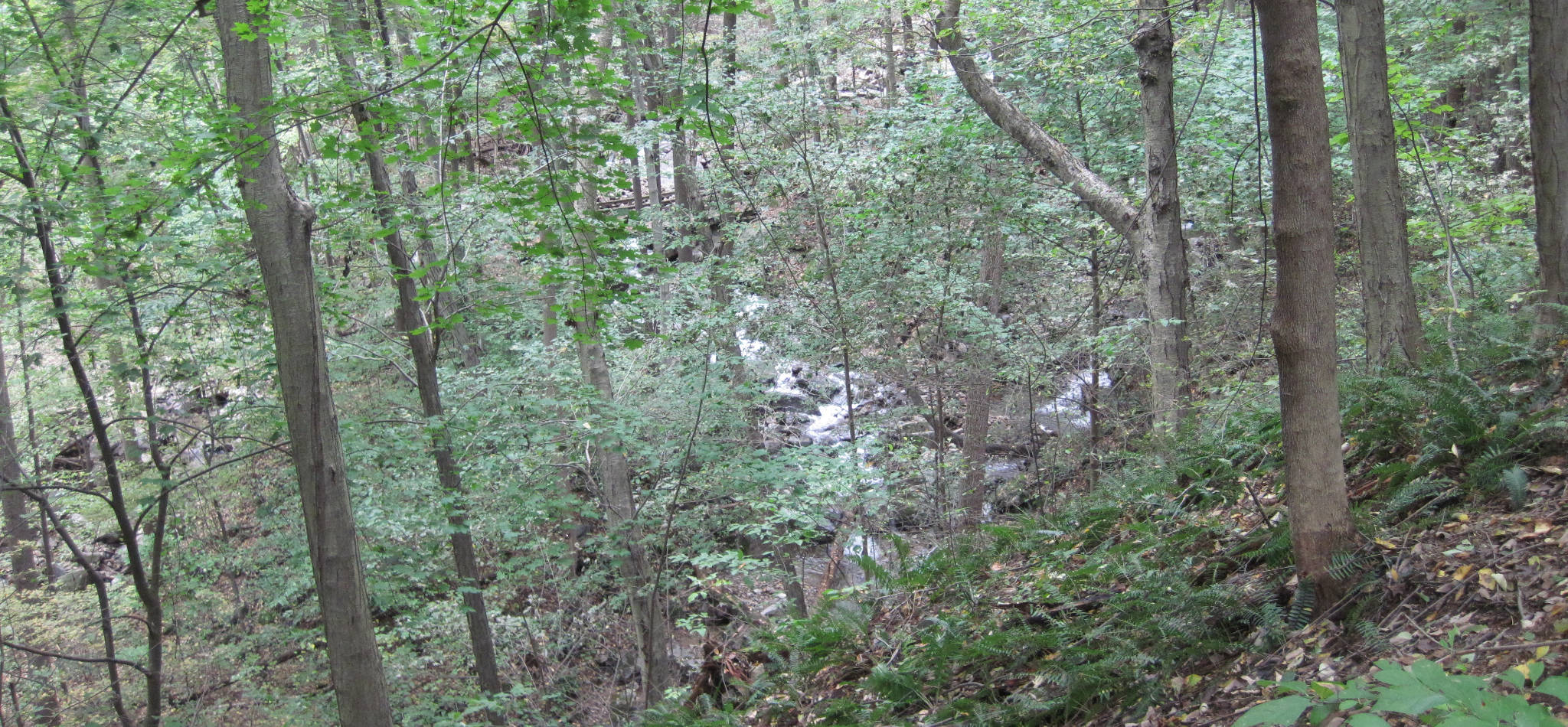
The preserve itself is great fun, with a fantastic loop hike at its core, which you can extend in various ways (click on the map to enlarge). The trail itself is pretty narrow and rocky in most places. You also get about 450 feet of elevation gain/loss in one pitch, plus a couple of additional descents/ascents from Scout Run for a total elevation gain of 600 feet or so. You’ll want to wear hiking boots (or walking shoes with a lugged sole), bring the map, and be prepared to cross a stream (Scout Run) on the southern part of the loop (the northern loop has a bridge over the worst bit). Normally, you can pretty easily hop on rocks over Scout Run, but if it’s just rained, you might have to step into ankle deep water.
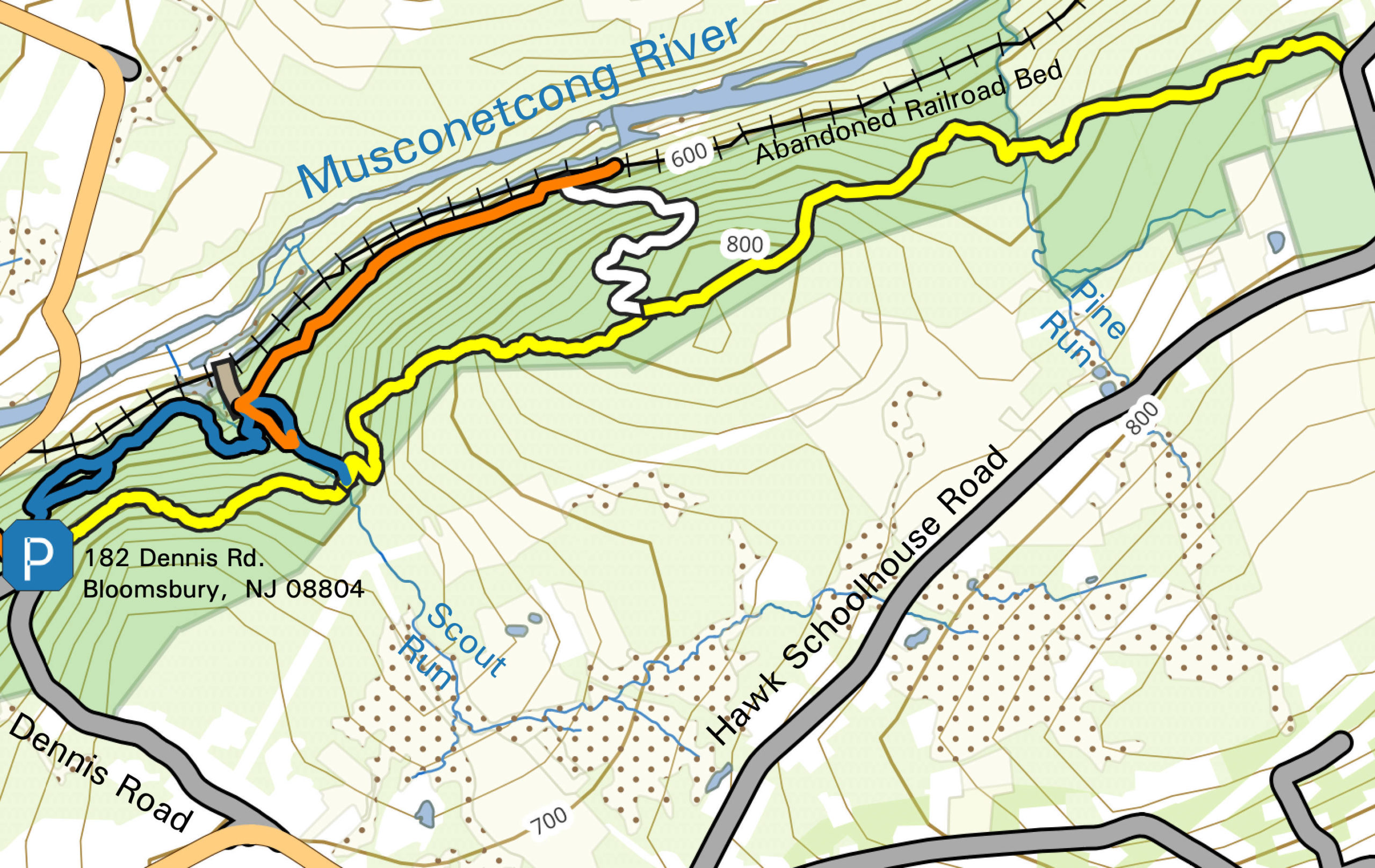
The phone number provided here is for the Hunterdon County Parks Department, which operates Musconetcong Gorge Preserve. There’s parking for a dozen cars or so on Dennis Rd, which is the principal trailhead. Just look for the sign where the road makes a 90 degree bend. Note the upper trail (yellow blazes) and the lower trail (blue blazes) both start here. My wife and I walked the loop trail counterclockwise (i.e. upper first). You can walk the trail in either direction, the difference being that if you go lower first (clockwise), you’ll get almost all of the vertical in one, long ascent up switchbacks (white blazes), and you’ll have to descend the steepest section of the entire hike, from the ridge into Scout run. By going counter-clockwise, you break the climb into two segments (the parking lot is at mid-elevation), and get to climb the steepest bit (which most people find easier than descending).
The loop itself will take you 90-120 minutes (it’s about 3.4 miles). You can extend it by continuing east along the ridge towards (or past) Pine Run, or (a little easier), walking east on the abandoned RR bed along the river.
Note the trail and the RR bed are different. If you do the trail counter clockwise, the trail starts only a few feet above the bed (which is a smooth, gravel road), and parallels it closely for a while. You can head west along the bed if you want… just watch the trail markers and bushwhack a few yards up to the trail when it starts to climb into Scout Run.
The park stays open during hunting season, but you should wear orange clothing if you go out, especially early December through mid February. It’s a great time because the leaves will be down, opening up the ridgetop views. But be hyper-careful of ice patches, especially the steep climb out of Scout Run on the lower loop.
Leave a Reply