

Clayton Park
Open dawn to dusk year round.
(732) 842-4000 Website Google Maps Trail Map GeoPDF
Gravitas: ![]() Challenge:
Challenge: ![]() Proximity:
Proximity: ![]()
Close and Smooth
Clayton Park has grown on me over the years, to the point that I now view it as an essential destination. Why?
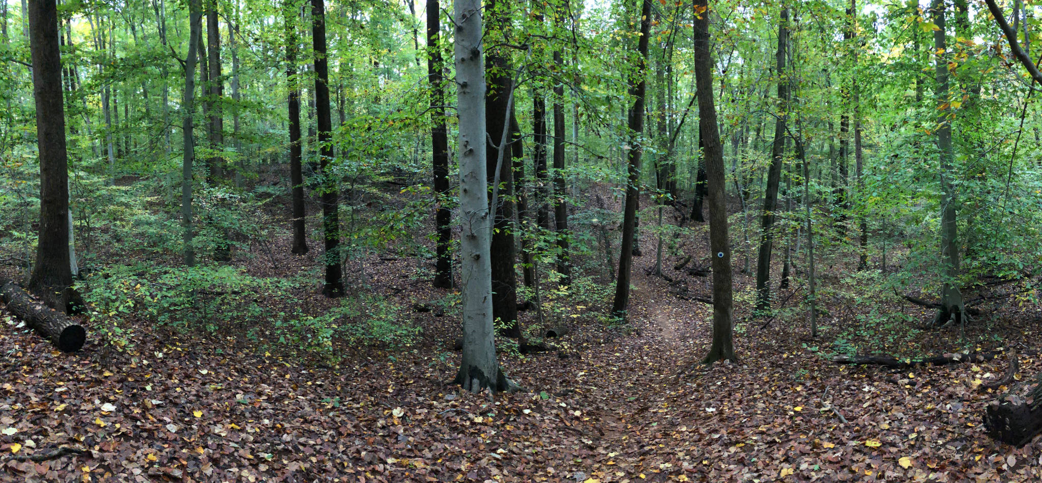
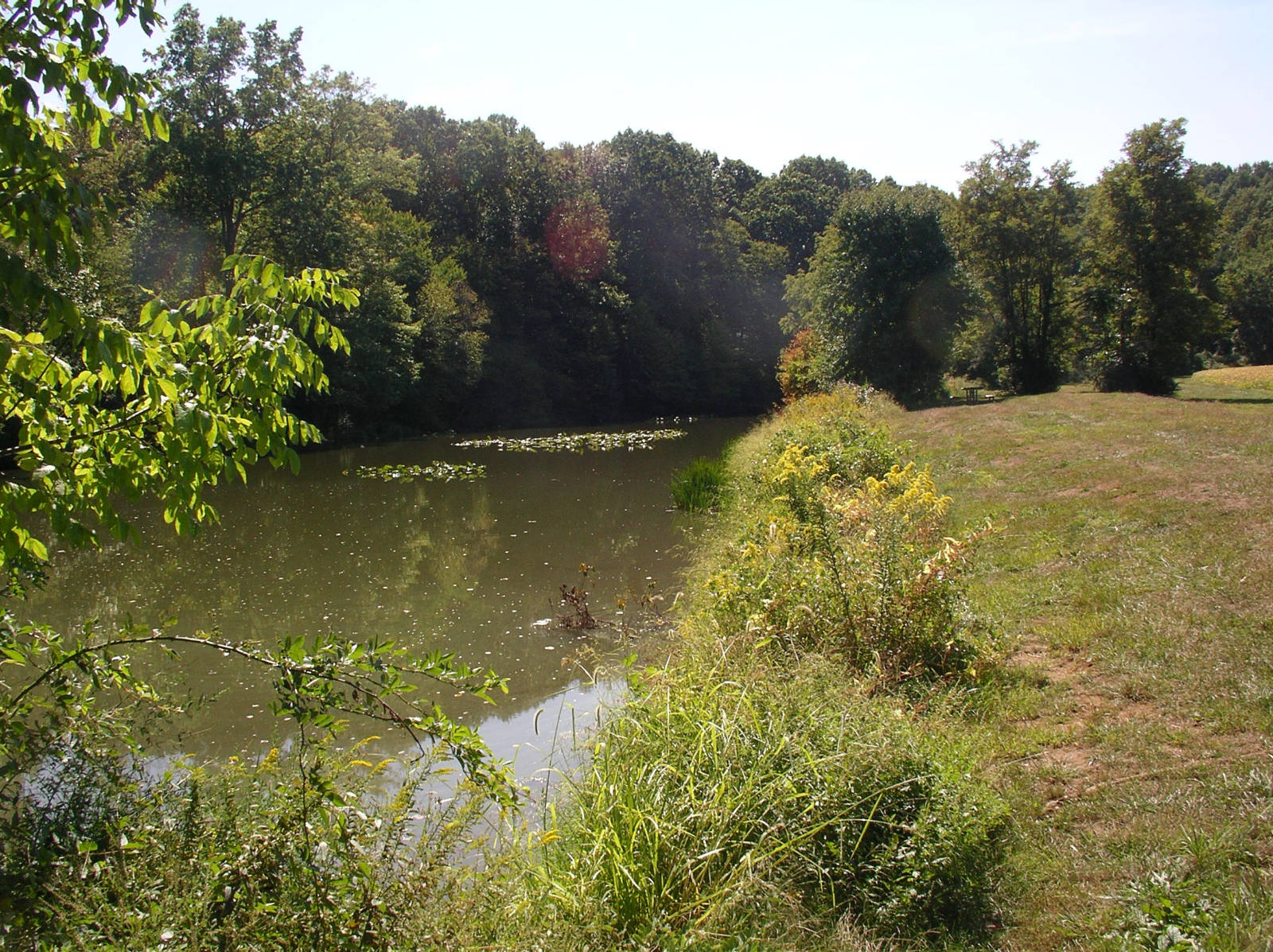
Part of the Monmouth County Park System, Clayton Park is a quick drive off I-195 Exit 11. It’s absolutely lovely, featuring 8 miles of trails through a mixed habitat of mature hardwood forest, wetlands, and fields. The topography is rolling hills…there’s no more than a hundred feet or so of elevation gain at any one climb, but you can string together a few of those climbs to improve the aerobic value.
The soil in Clayton park is sandy, and the trails are generally hard-packed, making for both easy footing (if you’re walking) or non-technical cycling (it’s a very popular mountain bike spot). There are few roots and even fewer rocks to trip you up.
Really, I adore the place and find myself returning to frequently:
- When a friend (who’s not a dedicated hiker) is visiting and wants a “wilderness” stroll
- When my wife and i are looking for an “easy” day out, or when one of us is recovering from an injury
- If we’ve had sustained rains, and most other trails are muddy. Clayton’s sandy soil drains quickly and, at worst, the trails get muddy in isolated spots that are easily avoided.
- When it’s just snowed, and we’re looking to do some X-C skiing
I have only two complaints: 1) it’s such a popular cycling spot that it takes some of the enjoyment out of hiking, especially on the weekends during the spring and summer, as you’ll be dodging bikes, and 2) the trail system is a little confusing…you’ll definitely want to bring a trail map with you the first few times you go out. You can print the PDF file we provide in the Trail Map link above. Better yet, load it into your smart phone. It’s one of our new “GR Series” which works with a free app called Avenza Maps, and will show your location using the GPS chip in your phone. Very useful, especially here.
Definitely check it out.
Ruth
My dog loved this walk- there are ponds and creeks for swimming and the underbush is not super dense so there is a little less worry about ticks. Nice easy walking, too.
Moises
Hello . Thanks for all this posts . I really enjoyed Baldpate & Clayton . I also recommend Sourland Mountain preserve( 30 minutes from Trenton) in Somerset county and Turkey Swamp where you can Kayak for $13/hour and have nice trails .
Please do not stop these postings I really appreciate it .
Thanks
Chris Pawlowski
Sourlands is nicest in this area
Hidden Trenton
Hey Chris, I love the Sourlands, and you’ll find a comprehensive review of it on the site (along with a GR series map). That said, don’t dismiss Clayton Park. It’s lovely, about 15 minutes closer to Trenton, and provides much easier footing (Sourlands is bouldery, whereas Clayton is smooth). If you’re looking for a relaxing walk through gorgeous, mature hardwood forest, Clayton is tough to beat.
Marianna Schultz
I enjoy Clayton all year round, though I really like snowy winter hikes through it!
cindy carlin
We can’t get trail map link to work!
The MillMan
Oops! My bad. Should work now.
ttu
Thank you for this and all your other efforts – much appreciated. Came here because of your accurate description after finding Baldpate closed for hunting W-Sat till 10 Feb. 2024. These Monmouth County parks with true old-growth woods (been to Hartshorne-Huber and now Clayton so far) are a glimpse into a living history (flora if not fauna) and well-maintained to boot. Agree with you on the biking – some of the best trail segments are little more than mountain-biking banked curves, and I don’t care for having to always be on the lookout for racers. But that’s no reason not to visit.
Note for first-timers like me who don’t use much GPS in the auto: Imlaystown is the nearest hamlet and the listed I-195 destination, and from there the County has directional signage. Parking in a grass lot, and as of Jan 2024 lot has a portable toilet. Monmouth County park system concepts and markings instead of blazes and different-named paths, so for example Doctors Creek trail is a sort of main stem with loops.