

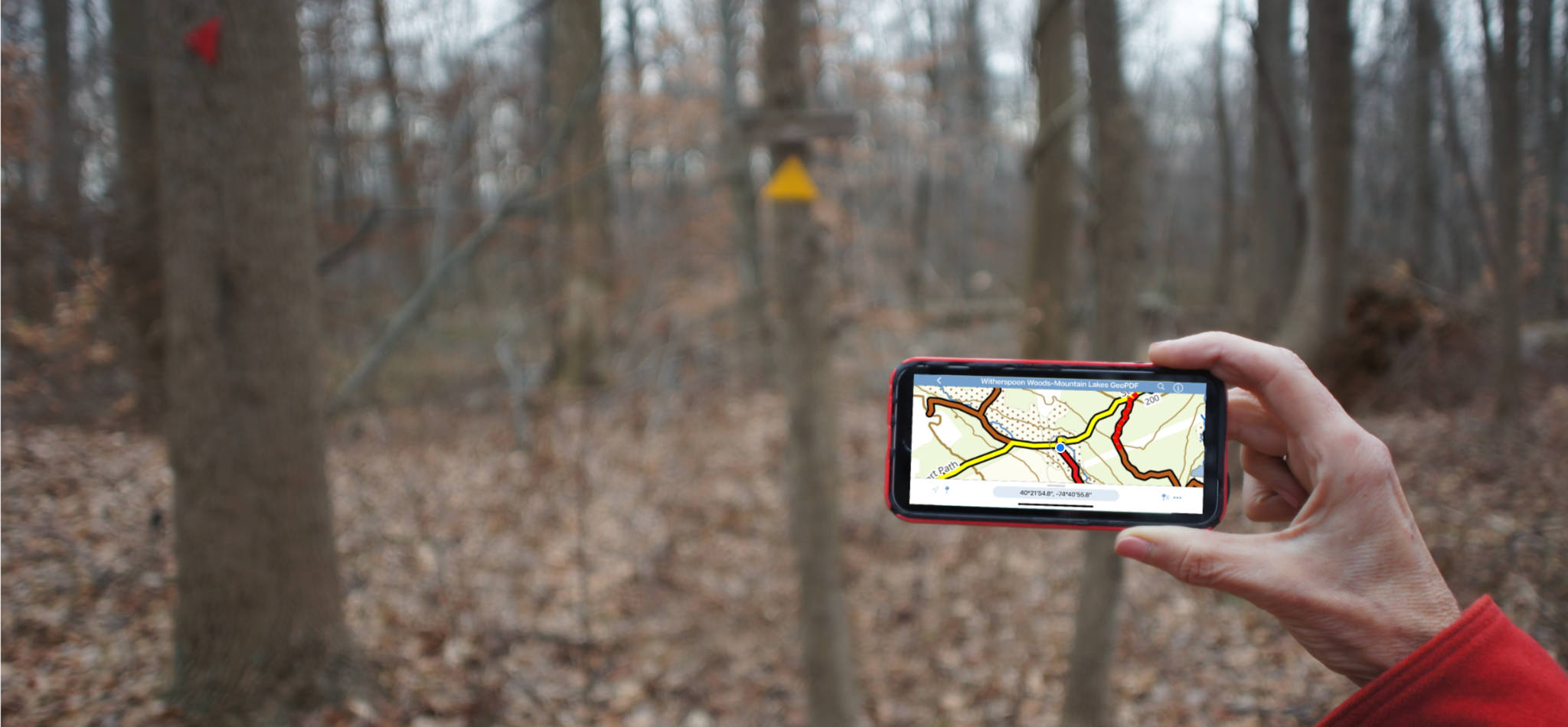
GeoPDF Trail Maps Show You Where You Are
Free, and exclusive to Central NJ Hiking!
Ever go hiking and wish you’d brought along a trail map? Or worse, you have a printed map with you, but you’ve not been paying attention. And now you’re kind of lost, and aren’t quite sure where you are? For me, the answer would be yes and yes.
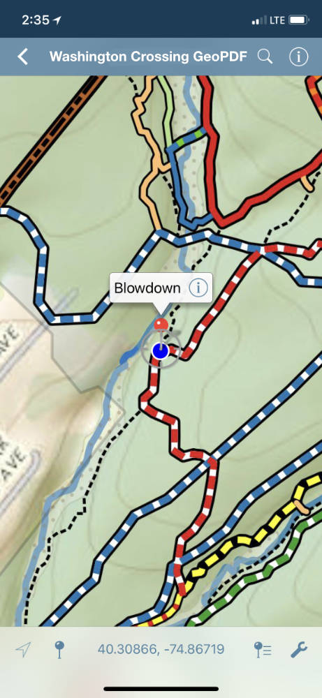
Well, if you have an iPhone or Android smart phone, you’re in luck. With our exclusive GeoPDF maps, you can see where you are on the trail, within about 50′. You can also record a track of your route, or drop “pins” for locations you want to remember.
If you get lost, you can drop a pin on where you want to go to (if you’re bushwhacking, typically the closest point on the trail you want), and your phone will give you a bearing. I won’t say it’s saved my life, but this feature has certainly shortened my time being lost.
No cellphone signal is necessary (just GPS satellite signals which are global).
You can tell which of our trail maps will work in a phone, because we added “GeoPDF” (short for geospatial pdf) to the end of the filename. Our goal is to create a GeoPDF map for every hike we review.
For these maps to work on your phone, you need to install a free app called Avenza Maps. Installation is straight-forward: instructions follow below the download links…
Click on the links below to download each map
Installation Instructions
IOS and Android have both made installation much easier than it used to be. Note that the free version of Avenza Maps will limit you to at most 3 CNJhiking maps active at one time (you can delete and add maps later if you run into that limit). For quick installation on an iPhone, follow these instructions, or see the links below to Avenza’s installation instructions for iPhone and Android:
- On your phone, click on the download links above for the map(s) you want. Your phone will save those maps to a file folder, probably “Downloads”
- Go to the App Store (iPhone) or Play Store (Android) and install Avenza Maps.
- Once it’s fully installed, open Avenza and go to the “My Maps” tab by clicking the icon at the bottom of your screen
- From the My Maps tab, click on the plus sign on the top bar. This opens the Import Map dialog
- Select “From Storage Locations“
- Navigate to your default downloads folder, probably “Downloads“
- Click on the map you want to import. Avenza maps will upload it, then process the geographic information, so it may take a minute or so.
- If you want to upload another map, repeat from step 4. Remember you’re limited to at most 3 active CNJhiking maps unless you buy a license for the Pro version of Avenza Maps. If you do run into this limit, just delete a map on the Avenza’s My Maps screen that you don’t need immediately. The file should remain in your downloads folder so you can always swap it back on another day.
For more information, check out these instructions on the Avenza website: iPhone instructions | Android Instructions.