Institute Lands: The Battle Walk
Dawn to Dusk Daily
Website Google Maps Trail Map GeoPDF Battle-walk Guide
Gravitas: ![]() Challenge:
Challenge: ![]()
![]() Proximity:
Proximity: ![]()
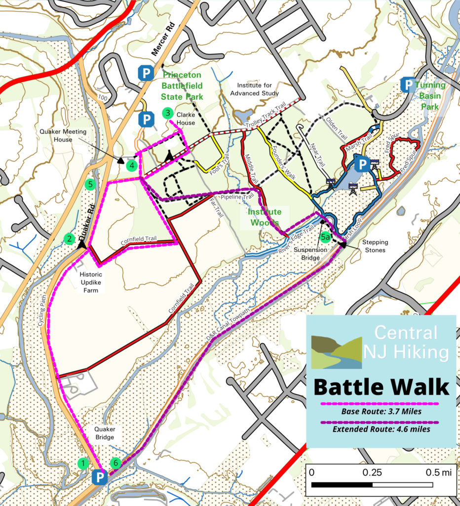
To stay true to the Army’s line of march, we strongly suggest that you start this walk at the D&R canal parking area in the far SW corner of the map. Downloading the GeoPDF map and installing it on your phone with Avenza Maps will simplify navigation enormously. We offer three route options: a base route of 3.7 miles, a “cheater” route where you drive part way (<2 miles), and an extended route of 4.6 miles which is a lovely way to see more of the Institute Lands. The short and cheater routes are fine for beginners; the longer route includes a segment on a trail that’s poorly maintained. You have to drop down into a drainage ditch, cross it on stepping stones, and scramble up a berm to access the tow path next to the canal. That’s tougher (and increases the challenge to Intermediate). Add in crossing a well-engineered and safe suspension bridge that’s bouncy, and you have a route many kids will love (but some will hate).
We’ve provided a brief, illustrated Guide to the Battle Walk which explains the historical significance of the sights. It also has important information about the routes, so is well worth downloading.
If you want to dive deeply into the history, you can also download a 98 page guide from our sister-site, Hidden Trenton. This covers all three battles (including the two Battles of Trenton), with much more background. It is designed primarily for a car tour, so it complements the Guide to the Battle Walk nicely.


Leave a Reply