

Wickecheoke Creek Preserve
No posted hours. Strongly recommended that you wear International Orange Clothing during firearms hunting season: Early Dec to mid-February
(908) 234-1225 Website Google Maps Trail Map GeoPDF
Gravitas: ![]() Challenge:
Challenge: ![]()
![]() Proximity:
Proximity: ![]()
When the Garden State Was...
This is a remarkably beautiful, entertaining hike redolent of the not so distant past when most Americans were employed as farmers, and NJ was nicknamed (without irony) the “Garden State”. There are still a few working farms in the area (many more “gentlemen’s farms”), and much of the woods you walk through here were open fields a generation or two ago. The suggested route is about 3.5 miles, of which about a mile is through open fields, 3/10 along a VERY lightly traveled, paved road, and 4/10 along a gravel road.
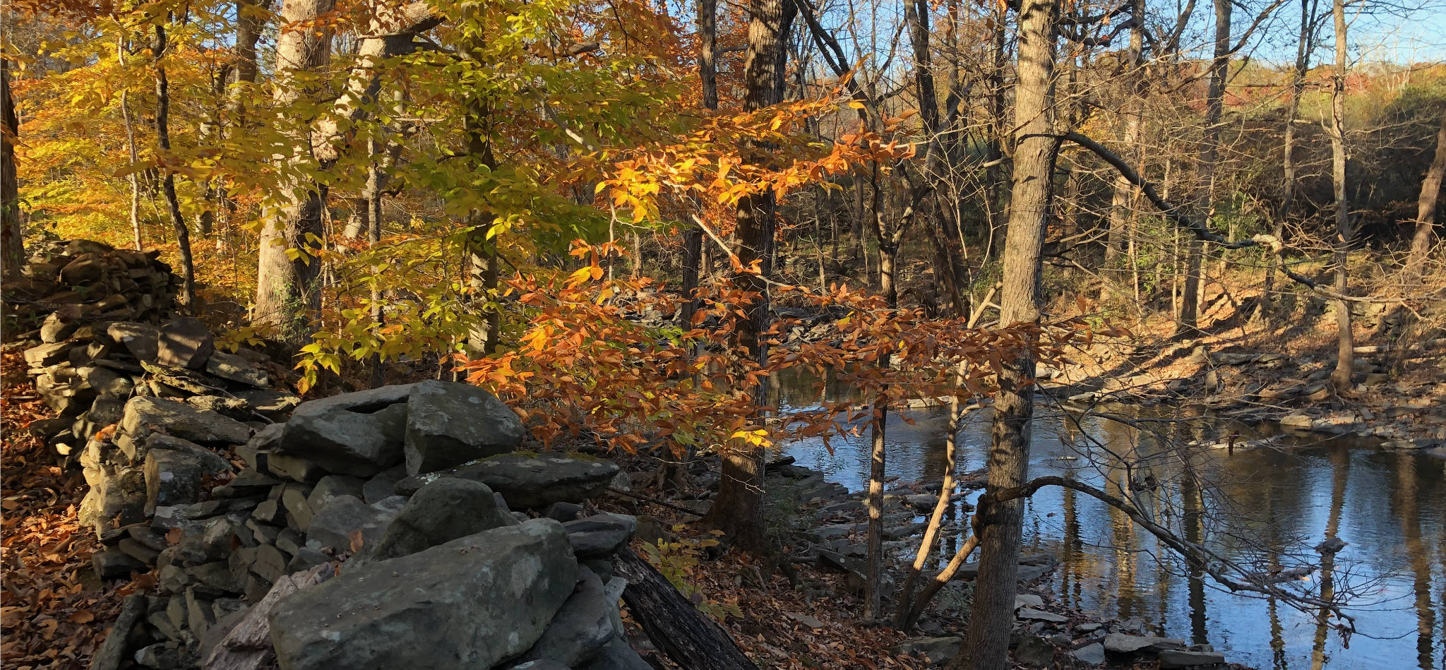
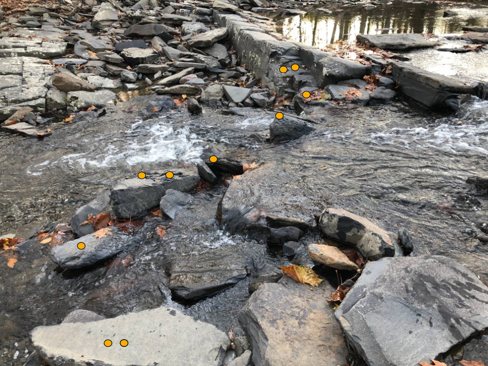
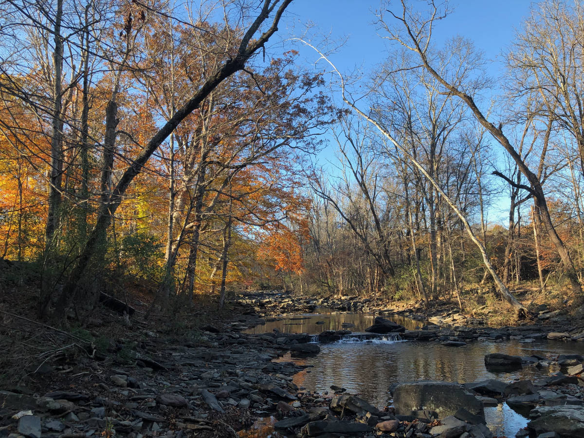
Wickecheoke Creek is, for New Jersey, a high-gradient stream that moves quickly and carves a deep ravine in places. The crossing on this trail is via stepping stones, requiring low water levels and confident hikers. If the water is running high, the crossing will be dangerous.
The suggested route starts at a small parking area off of Upper Creek Road. To follow these directions, download the GeoPDF trail map.
From the parking lot, there’s a green-blazed trail that edges two meadows (tunneling briefly through a woods break). The trail then turns south to parallel Wikechoeke Creek (and the handsome stone wall in the top photo) then drops you onto the bank where an unnamed tributary joins. Footing here can be tricky, as it’s quite bouldery, and some are unstable.
If the water’s low enough, you’ll cross here and pick up the blue-blazed trail heading downstream for a few dozen yards, then turn left onto the Red Blazed trail. It will take you to Pine Hill Road and its bridge over Plum Brook. You’ll then descend immediately after the crossing to continue on the red-blazed trail paralleling Plum Brook for 4/10 of a mile. While the path is more or less level, the footing remains tough. In the fall of 2021, you had to cross a number of downed trees and deal with flood damage along the trail, as well as crossing two small creeks draining Pine Hill. None of this is terribly difficult, just slow.
Ultimately, the trail will turn right about 270 degrees, and you will start heading straight up Pine Hill. You’ll climb about 140 vertical feet over a quarter mile until you break-out onto a large meadow. The climb is never gets steep, but you’re completely dependent on the blazes to follow the trail through the woods, especially in the autumn when newly fallen leaves obscure the minimal signs of foot-wear on this lightly used route.
Unfortunately, the trail markers disappear in critical spots. I lost the trail about half way up the hill, used my GeoPDF to correct my course, eventually spotted a marker to regain the trail, and then lost it again somewhere about 150 yards from the edge of the woods. At that point it was obvious I was reaching height of land, so I bushwhacked onto the meadow. For me, this is part of the fun, but I was very glad I carried the GeoPDF map installed in my phone. If this makes you nervous, think about picking a different hike.

Once on the meadow, there is a mowed path that heads east paralleling the edge of the woods, then turns almost due south, following a wind-break, towards Pavilica Road. This meadow trail is not marked on any map that I’ve seen (except CNJhiking’s, now), but it was described to me by some locals I met at the Pine Hill Rd bridge performing trail maintenance. I’m glad they did, as I wouldn’t have attempted it otherwise. After a quarter mile the trail cuts through the wind break and reveals a small, extremely old cemetery in the middle of the field. While I didn’t have time to look carefully, the ancient headstones are badly eroded and largely illegible. Avoid the temptation to short-cut to the cemetery, as there’s a well mowed path to reach it from the south.
To get home, you have the choice of turning around and returning the way you came, or continuing south to reach Pavilica Road. This is very quiet country lane with almost no traffic, and I was pleased to walk on an even, firm surface for a while. You turn right onto Pine Hill Rd to return to the bridge. If the leaves are down (and they mostly were the day I walked this route), you’ll enjoy spectacular views through the trees down into the Wickecheoke gorge. The bank on this side is VERY steep.
Then cross the bridge and return the way you came. It’s all pretty straight forward from here, except you have to take the stepping stones over Wickecheoke Creek again, and tired legs require extra concentration.
We rate this hike intermediate because of the poor footing and the need to cross the creek, and advanced if you intend the full circuit because of the poor state of the trail blazing. Beginners can easily enjoy the Green trail and not have to cross the stream. It offers spectacular views of the far bank.
Dennis Waters
I am glad to hear that this section of the preserve mostly survived the Ida flooding. The downstream stretches along Lower Creek Road were apparently scoured out pretty badly.
Note that there is also a nice trail on NJCF property that runs parallel to Plum Brook upstream from the confluence with the Wickecheoke.
Admin
Hey Dennis, thanks for the comment. The “nice trail on NJCF property that runs parallel to Plum Brook upstream” is on the map, but I avoided it because it required a second stream crossing close to the Wickecheoke, and the water levels in Plum Brook were pretty high. I can’t wait to explore some more of the area, but I had a GREAT first excursion there. The folks I ran into at the bridge apologized for the state of the trail. Not knowing how it was before, all I can say is that is was challenging but passable. I wish I’d brought my hiking staff, and will the next time I go. The main problem is footing on rocks when close to stream (which is only part of the walk), which definitely suffered from Ida damage, as well as crossing the small streams feeding Plum Brook. Also, Lower Creek Road is still closed, so Ida damage is no doubt extensive.