

Sourland Mountain Preserve
Open daily, sunrise to sunset
(908) 722-12005 Google Maps Trail Map GeoPDF
Gravitas: ![]() Challenge:
Challenge: ![]()
![]()
![]() Proximity:
Proximity: ![]()
Elevation Gain Close By
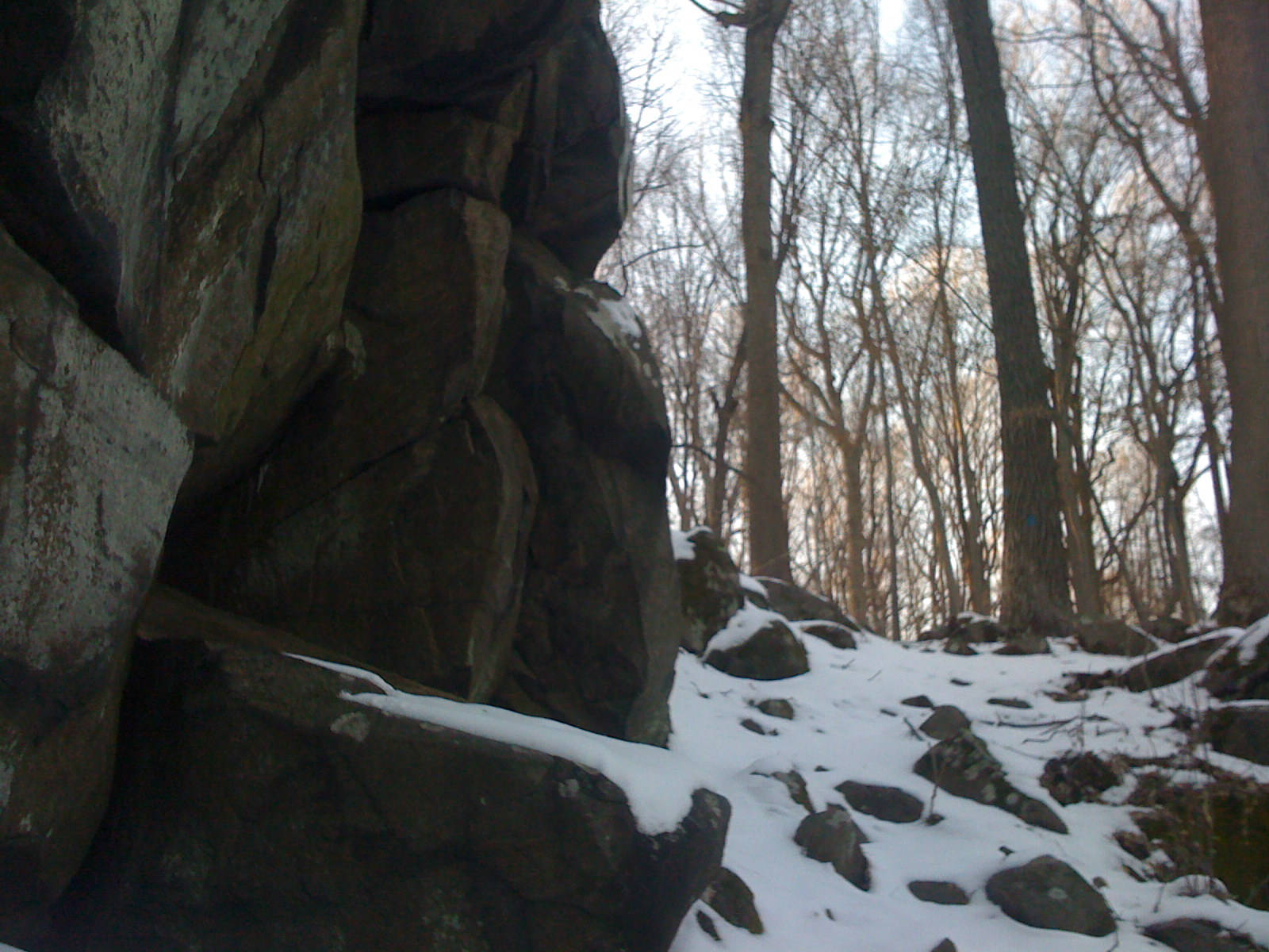
Less than 20 minutes from downtown Princeton, The Sourlands is the closest trail system where you can experience reasonable elevation gain, up to about 350 vertical feet on the tallest trail. Beginners can do some short loop hikes near the parking lot, while Intermediate hikers have miles of trails in the southern section with moderate grades. Many of the trails pass through interesting rock formations (though scrambly bits are rare).
Compared to other parks in the area, the trails make for more rugged walking, because they are quite rocky (though beginner trails have been fairly well graded) and generally purpose-built for hiking (not converted woods roads). After the Sourlands and Baldpate, the next closest hike with a higher elevation gain is half an hour further away.
Operated by the Somerset County Park Commission, the trails are well maintained and marked. In recent years the County has invested heavily in the system, added a major trail, relocated some trail segments, closed a couple of marginal trails, and completely re-blazed the entire park. This screen shot is from our newly revised map that captures all of these changes. Note, our map has North at the top, unlike the county’s trail map, so if you’re used to looking at the county map, you’ll need to reorient yourself.
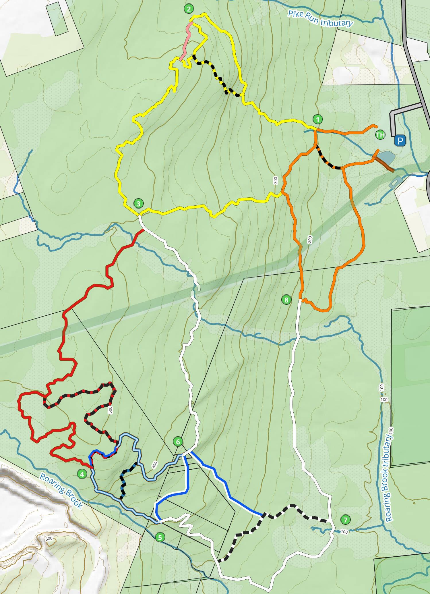
While the scale isn’t obvious, the trails along the circumference of the park total about 10 miles. The system allows walks of all distances and difficulties from moderately easy to pretty strenuous. You can divide the park into two sections: North of the gas pipeline (which is shown as the thick green line across in the center of the map), and South. The northern trails, particularly the Yellow and Yellow-dot trails, are steepe, more rugged, and more compact. South of the pipeline, the distances are longer. The white trail mostly parallels the contour lines, making for a flatter hike, well suited to “Intermediate” hikers. However, the trails close to Roaring Brook, near markers 4-6, are nearly as rugged as the Yellow trails. Fit hikers can easily devise routes across both sections.
There’s one scenic view in the park, where the white trail crosses the gas pipeline right-of-way: on a clear day you can see lower Manhattan. The pipeline right of way itself is walk-able and quite steep in places. It allows you create multiple route variations without needing to spend hours in the park. Watch out for mountain bikers speeding down the hill and bring a sun hat as there’s little shade.
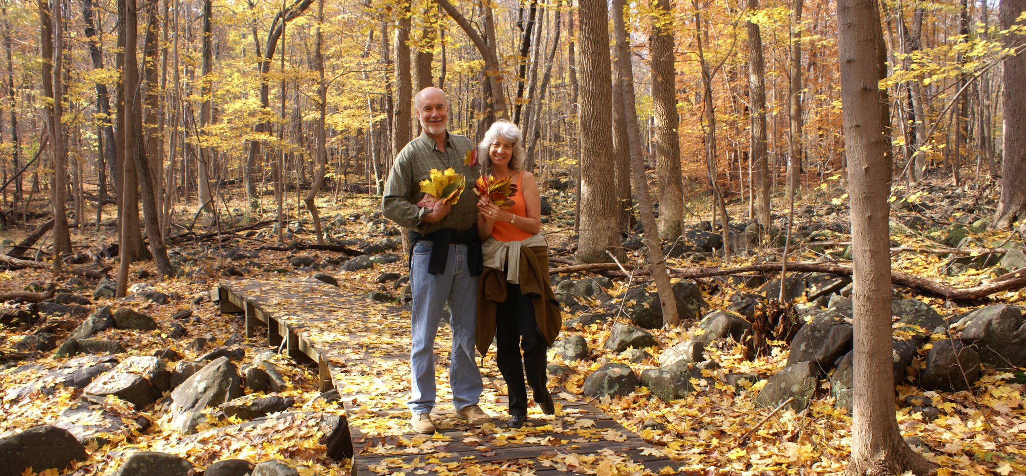
BTW, the couple in the banner photo is my brother and sister-in-law. They live in Marin County, and hike all over California. They LOVE the Sourlands with its trees, leaves, and boulders.