

Valley Forge NHP: Mt. Joy / Misery Hike
Open daily, dawn to dusk
Website Google Maps Trail Map GeoPDF
Gravitas: ![]() Challenge:
Challenge: ![]()
![]() Proximity:
Proximity: ![]()
Walking on the Spine of History
How do you feel about a 4 mile loop hike on one of the country’s most hallowed historic sites, just 45 minutes from Trenton? It’s one of the hikes I return to at least a couple of times each year, and recent improvements by the Park Service make it even better hike, rationalizing the cross-over from Mt. Misery to Mt Joy trails which used to be, frankly, a mess and is now a pleasure.

We recommend hiking in a counter-clockwise direction, starting where Valley Creek meets the Schuylkill, south over the Mt. Misery ridge, crossing Valley Creek, and back over Mt. Joy. Be sure to download the GeoPDF version of this map which, if you install it with Avenza Maps, will show your location on your smartphone and give you the confidence to explore some of the lesser traveled trails.
Valley Creek runs through a fairly steep valley. “Mt. Misery” is the taller bank, on the western side of the Creek. “Mt. Joy” is on the eastern bank. “Mountain” is relative, they’re really hills providing a few hundred feet of elevation gain. Note that the actual summit of Mt. Misery is outside of the park boundaries in the middle of a housing development.

Slopes are moderate, and footing is generally pretty easy. Highly fit beginners will find they can complete this hike without too much difficulty, though we rate it Intermediate to Experienced given the cumulative elevation gain for the full hike. Beginners who want to avoid the elevation gain, can simply walk along Valley Creek.
If you’re looking for some challenge, the Wolfinger Trail is the steepest in the park, connecting the Mt. Misery Trail with the Valley Creek Trail, and makes a great variation. As with all very steep trails, I recommend walking up. If you’re doing the whole loop, just pick up the Valley Creek Trail where it connects to Horseshoe, then up Wolfinger back to the Mt. Misery Trail.
In addition, you’ll find an unmarked trail labeled “Recommended” that provides an alternative to parts of the Horseshoe and Mt. Misery Trails. It’s a slightly more challenging trail with views into a creek bed. Lovely. Either of these alternatives increases the challenge level of this hike to “Experienced”.
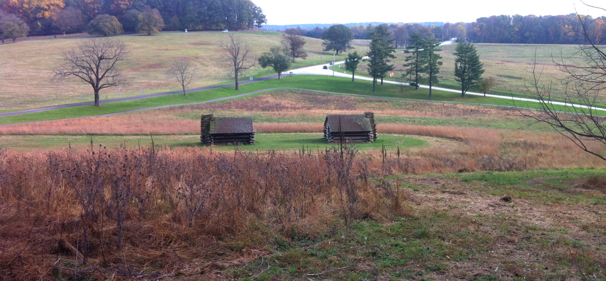
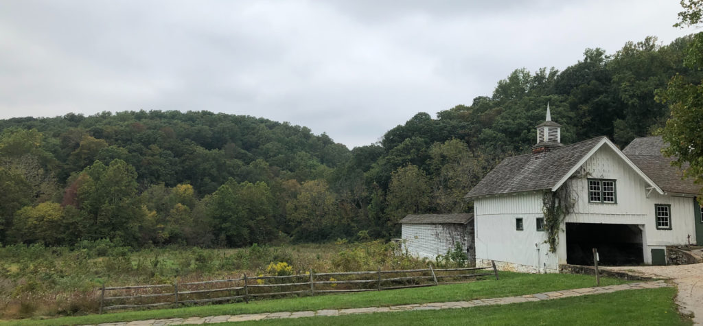
Whatever route you take, the extra “juice” from the historical significance of the site, and the beauty of the location, makes it something that anyone who lives in central NJ, and loves to walk, should do at least once. Kids are likely to enjoy walking through the ruins of an old mill (on the Mt. Misery side, the one downside of following the recommended cutoff is you miss it). There’s also an old fashioned covered bridge over Valley Creek which is just off the trail, and reconstructed huts similar to winter sleeping quarters for Washington’s troops.
Valley Forge is the site of the Continental Army’s winter camp of 1777-8, a full year after its victories at the Battle of Trenton* (where they wintered in Jockey Hollow, NJ, another favorite hike). Today Valley Forge is connected by high speed roads (Rt. 1 and the PA Turnpike), so it takes only about 45 minutes to drive there from Trenton, or an hour from Princeton, even if you more or less observe the speed limits.
Valley Forge is located where Valley Creek hits the Schuylkill River, which then flows into the Delaware at Philly. High quality water was a prerequisite for siting a long-term army camp, and it’s no accident that the stream which run through Valley Forge is among the few in the area still supporting wild trout. The stream bed of Valley Creek is limestone, and the water is usually crystal clear.
The stream hasn’t been stocked since the 1960s, when PCB pollution was discovered in the stream (from a transformer factory upstream) and it was realized that eating these fish was hazardous to human health. It’s been managed as a wild trout fishery since then, catch and release only. These are smart, wary wild brown trout. Being the closest PA Class-A trout stream to Philly (less than 30 minutes from downtown), it gets a fair amount of pressure, but it’s absolutely lovely.
_____________
*The battles of Trenton were a critical turning point in the war, as news of the victories convinced the French to join us in the war. The British were driven back to New Brunswick, sheltered by the guns of the Royal Navy, and the American Army wintered at Jockey Hollow, near Morristown.
Admin
As of early October, 2021, the Valley Creek trail is closed from its beginning at the Covered Bridge to the Wolfinger Trail due to post-Ida flooding damage. The northern half of the trail remains open connecting Wolfinger to the Horseshoe Trail.